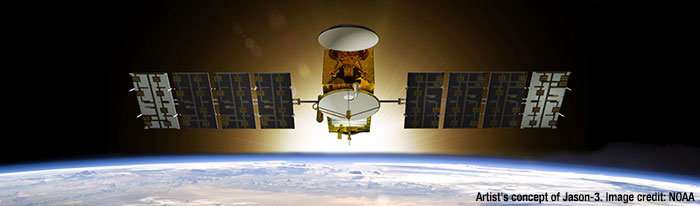
Jason-3 satellite mission helped detect an acceleration in sea level rise. Credit: NOAA
Global sea level rise is not cruising along at a steady 3 mm per year, it’s accelerating a little every year, like a driver merging onto a highway, according to a powerful new assessment led by CIRES Fellow Steve Nerem. He and his colleagues harnessed 25 years of satellite data to calculate that the rate is increasing by about 0.08 mm/year every year—which could mean an annual rate of sea level rise of 10 mm/year, or even more, by 2100.
“This acceleration, driven mainly by accelerated melting in Greenland and Antarctica, has the potential to double the total sea level rise by 2100 as compared to projections that assume a constant rate—to more than 60 cm instead of about 30.” said Nerem, who is also a professor of Aerospace Engineering Sciences at the University of Colorado Boulder. “And this is almost certainly a conservative estimate,” he added. “Our extrapolation assumes that sea level continues to change in the future as it has over the last 25 years. Given the large changes we are seeing in the ice sheets today, that’s not likely.”
If the oceans continue to change at this pace, sea level will rise 65cm (26 inches) by 2100—enough to cause significant problems for coastal cities, according to the new assessment by Nerem and several colleagues from CU Boulder, the University of South Florida, NASA Goddard Space Flight Center, Old Dominion University, and the National Center for Atmospheric Research. The team, driven to understand and better predict Earth’s response to a warming world, published their work today in the journal Proceedings of the National Academy of Sciences.
Rising concentrations of greenhouse gases in Earth’s atmosphere increase the temperature of air and water, which causes sea level to rise in two ways. First, warmer water expands, and this “thermal expansion” of the oceans has contributed about half of the 7 cm of global mean sea level rise we’ve seen over the last 25 years, Nerem said. Second, melting land ice flows into the ocean, also increasing sea level across the globe.
These increases were measured using satellite altimeter measurements since 1992, including the U.S./European TOPEX/Poseidon, Jason-1, Jason-2, and Jason-3 satellite missions. But detecting acceleration is challenging, even in such a long record. Episodes like volcanic eruptions can create variability: the eruption of Mount Pinatubo in 1991 decreased global mean sea level just before the Topex/Poseidon satellite launch, for example. In addition, global sea level can fluctuate due to climate patterns such as El Niños and La Niñas (the opposing phases of the El Niño Southern Oscillation, or ENSO) which influence ocean temperature and global precipitation patterns.
So Nerem and his team used climate models to account for the volcanic effects and other datasets to determine the ENSO effects, ultimately uncovering the underlying sea-level rate and acceleration over the last quarter century. They also used data from the GRACE satellite gravity mission to determine that the acceleration is largely being driven by melting ice in Greenland and Antarctica.
The team also used tide gauge data to assess potential errors in the altimeter estimate. “The tide gauge measurements are essential for determining the uncertainty in the GMSL (global mean sea level) acceleration estimate,” said co-author Gary Mitchum, USF College of Marine Science. “They provide the only assessments of the satellite instruments from the ground.” Others have used tide gauge data to measure GMSL acceleration, but scientists have struggled to pull out other important details from tide-gauge data, such as changes in the last couple of decades due to more active ice sheet melt.
“This study highlights the important role that can be played by satellite records in validating climate model projections,” said co-author John Fasullo, a climate scientist at the National Center for Atmospheric Research. “It also demonstrates the importance of climate models in interpreting satellite records, such as in our work where they allow us to estimate the background effects of the 1991 eruption of Mount Pinatubo on global sea level.”
Although this research is impactful, the authors consider their findings to be just a first step. The 25-year record is just long enough to provide an initial detection of acceleration—the results will become more robust as the Jason-3 and subsequent altimetry satellites lengthen the time series.
Ultimately, the research is important because it provides a data-driven assessment of how sea level has been changing, and this assessment largely agrees with projections using independent methods. Future research will focus on refining the results in this study with longer time series, and extending the results to regional sea level, so they can better predict what will happen in your backyard.