Drugmakers aren’t the only ones upgrading their data plumbing. While Moderna works with Benchling to build out an R&D data platform, NASA has trained a 3 billion parameter model on 100 million Moderate Resolution Imaging Spectroradiometer (MODIS) satellite images to pull new signals from 25 years of Earth-observation data.
Introducing SatVision-TOA
The resulting model, known as SatVision-TOA (Top-of-Atmosphere), can accurately predict the shape of objects in obscured images while spotting features for analysis. NASA notes that the model has “broad applications,” ranging from retrieving cloud properties, urban planning, land cover mapping, monitoring floods and disasters, and environmental analysis.

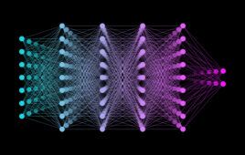
Another factor that makes SatVision-TOA noteworthy is that its architecture as a “geospatial foundation model” is built on a similar transformer neural network architecture as large language models. This approach allows the model to learn general visual patterns from the MODIS archive, which can then be adapted for downstream tasks.
NASA has made the model’s architecture and weights openly available on platforms like GitHub and Hugging Face as a PyTorch-based package.
NASA widens AI push from data mining to orbital safety
Outside of SatVision-TOA (Top-of-Atmosphere), NASA is tapping AI in a range of applications. Earth Copilot, a chatbot built with Microsoft’s Azure OpenAI Service, entered internal testing in November 2024. It sits on top of more than 20 petabytes in the VEDA archive and can handle plain-English prompts. Think “How did Hurricane Idalia reshape West-Central Florida’s coastline?”

NASA’s new Earth Copilot [Image courtesy of Microsoft]