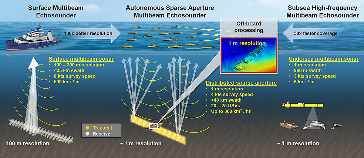
Detailed knowledge of seafloor topography is valuable for applications ranging from locating missing objects and undersea resources like oil and minerals to tracking human impacts, monitoring marine life, and modeling deep-ocean currents’ climate effects. Yet, most of the Earth’s oceans remain largely unmapped. The challenge lies in the lack of technology capable of producing high-resolution, meter-scale bathymetry at scale. While ocean-mapping ships with multibeam echo sounders provide broad coverage, they only deliver low-resolution data. Mapping areas deeper than 1,000 meters, which cover 85% of the ocean, requires sending underwater vehicles near the seafloor, a method that limits coverage and adds significant costs. The MIT Lincoln Laboratory’s sparse-aperture sonar technique bridges this gap by offering a novel approach — delivering seafloor maps at 100x the resolution of surface vessels and 50x the coverage rate of underwater vehicles.